ITALIA
Tuscan Mining UNESCO Global Geopark
An eco- journey though history, in mines, nature and green innovation
About the geopark
Tuscan Mining UNESCO Geopark, north of the Tuscan Maremma region, extends over an area that rises from the sea to the hills of the inner land.
The territory of the Park is a treasure chest of Geodiversity and Biodiversity, a mosaic of habitats that is extremely heterogeneous: from the sand dunes and rocky shores of the Gulf of Follonica , to the coastal wetlands in the Scarlino area, to the spectacular and unique geothermal phenomena of the Biancane of Monterotondo Marirriamo, to the scrublands and hilly forests of Gavorrano and Massa Marittima, to the sub-mountains of the Cornate di Gerfalco, the Poggio di Montieri, the Sassoforte or to the magnificent Val di Farma in the territory of Roccastrada.
Established in 2002 by Decree of the Ministry of the Environment covers an area of 1187 square kilometers, originally includes the territories of seven municipalities: Follonica, Scarlino, Gavorrano, Massa Marittima, Montieri, Monterotondo Marittimo, Roccastrada.
In 2022, the Tuscan Mining UNESCO Global Geopark was enriched by the inclusion of the geothermal areas of the territories of Castelnuovo in Val di Cecina, Pomarance (in the province of Pisa) and Radicondoli (in the province of Siena)
In its 118,700 hectares of extension, the Park includes 34 mining sites, 41 geosites, more than 250 minerals and rocks surveyed that tell 300 million years of geological history, about 19,000 hectares of protected areas dedicated to Biodiversity (Nature Reserves, Natura 2000 sites, biotopes, a Ramsar wetland), 139 hot spots and sites of historical, archaeological and landscape interest, hundreds of kilometres of pedestrian, bike and horse trails.
In each of the municipal territories, there is one or more «Gateway to the Park«, which are Reception Centres, Information Points, Documentation Centres and Museums, and where you can book or have informatin on itineraries and guided tours, educational workshops, seminars, vocational training courses, eco tourism experiences and research activities in cooperation with many international universities.
History
A geological History of 300 Millions of Years and 5000 years of Mining activities.The ancient geology of the area dates back 300 Million Years, speaking us trough its incredible geodiversity of many eras, climates, habitats and landscapes that where succeeding on the area. Educational tools and professional guides will help you to discover those secrets.
Man has lived in this area since prehistoric times and has always been able to exploit the riches of the Earth, the georesources. From the Copper Age, around 3000 years Before Christ, to the late 1990s, through prehistoric, Etruscan, Roman, medieval and Renaissance populations, and continuing into the 19th and 20th centuries, for almost five thousand years this area has been the cradle of the exploitation of rocks and minerals, metals and other resources of the Earth (georesources) that have supported the evolution and marked the events of various civilisations and cultures.
Main attractions
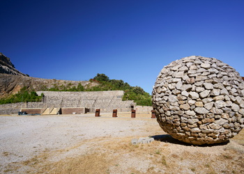
The headquarters of Parco delle Colline Metallifere and the Teatro delle Rocce
The site includes the area where the headquarters of the Parco delle Colline Metallifere is located, in the charming building of the ex “Bagnetti” of the Montecatini Company; the GeoMet, museum of geodiversity and mines, base from which to start discovering the multifaceted territory of the Park; the Museo Minerario in Galleria, housed in a section of the ancient explosives storage gallery of the Gavorrano Mine, where you can relive the life of the miner firsthand and the Teatro delle Rocce, a charming open air Theatre set up inside an imposing limestone quarry, where it is possible to attend artstic performances and concerts.
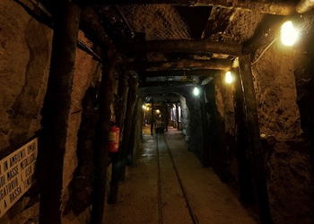
Mining Museum in a real gallery
The museum is housed in the so-called “riservetta”, a mining gallery that served as an explosives store. The itinerary shows the different phases of the mining site, the cultivation techniques, the support works, but above all, through the guide’s narration, but also thanks to lights, images, sounds and multimedia installations, makes visitors relive the historical events and the extremely harsh environmental and working conditions inside the Gavorrano Mine. Guided visits only. The cost of the guide is included in the entrance fee.
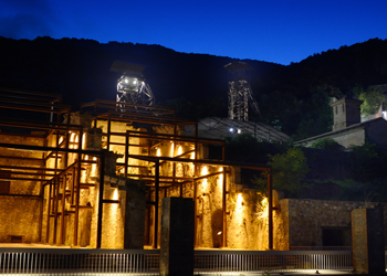
Ravi Marchi Mine
The Ravi-Marchi mining area is an open-air industrial archaeology site, complementary to the visit of the Museum in the Gallery. Here, it is possible to visit the surface installations of the Marchi Mine for the treatment of pyrite, which were decommissioned in 1965 and have now been restored. In addition to the peculiar history of this mine, the visit helps to understand the route and processing of the ore once it has been brought up from underground. Guided visits only. The cost of the guide is included in the entrance fee. In addition to guided tours, the site can be used for educational workshops, cultural events and theatre performances, conferences and open-air meetings.
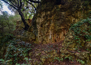
The Travertines and the Cathedral of Massa Marittima
In the heart of the Geopark, on a plateau of cold-water travertine (Calcareous tufa) formed in an ancient fluvio-lacustrine environment 130,000 years ago, lies the medieval town of Massa Marittima. The stones of the historic buildings and the walls of the imposing Cathedral of San Cerbone guard the memory of this past and tell us, like the pages of a book, that there was once a vast plain with lakes and marshes, interspersed with small waterfalls, and that over the course of geological periods, the environment that once was, has been transformed into a hillside.
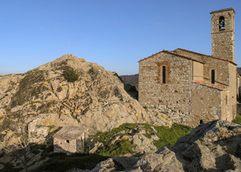
The lava dome of Roccatederighi
The charming medieval village of Roccatederighi, with its stone houses and cobbled streets, stands on a lava dome, active between 2.6 and 2 millions years ago during the Pliocene. Its oval shape and volcanic rocks shaped by time are a unique geological spectacle. Strolling through the narrow streets, we can learn about rhyolite, the volcanic rock from which the ancient houses were built, and discover how water and wind, like true sculptors of the landscape, have modelled it, creating curious shapes and suggestive sculptures.
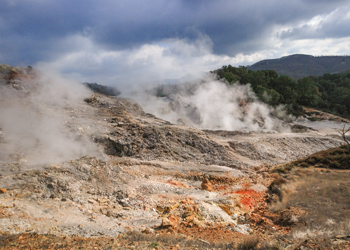
Biancane Geothermal site
This is a unique geological site, a lunar landscape shaped by the Earth’s heat that comes from the depths and manifests itself on the surface through spectacular blowholes that emit steam at high temperatures (up to 100°C). Walking along the paths of this place, where the force of nature manifests itself in all its power, one is enraptured by the colours of the rocks ‘burnt’ by geothermal activity that contrast with the intense white of those ‘washed’ by the circulation of hydrothermal fluids, hence the name ‘Biancane’. Along the way, one can observe sulphur crystals forming, witness the gurgling of the muddy waters of a small lake fed by steam rising from underground, and enjoy breathtaking landscapes.
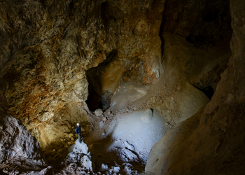
The Alunite Quarries of Poggio Speranzona
Immersed in the wilderness, these quarries bear witness to the intense mining of alunite, sulphate of aluminium and potassium, which began in the 15th century and continued until the 19th century. The considerable interest in this mineral is due to its use since antiquity in various sectors, from tanning leather to medicine. The geological site is impressive for the splendid colours of the altered rocks that contrast with the immaculate white of the ore and for the numerous open-pit quarries and galleries, some of truly impressive dimensions, once again, irrefutable proof of the skill of the ancient miners
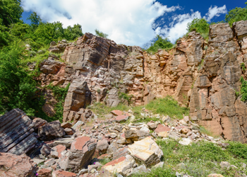
The Mines and Quarries of Poggio Mutti and Cornate di Gerfalco
At Poggio Mutti, a ring-route of about 2 km allows visitors to explore mine-caves, dug into the heart of the earth, which bear witness to the deep knowledge of nature and the resources of the subsoil and the ingenuity and skill with which the ancient miners extracted minerals in search of silver useful for minting coins.
The relief of the Cornate di Gerfalco, the highest in the Colline Metallifere, is told through its rocks, silent witnesses to the geological events that took place millions of years ago, along a route of about 2.5 km. You will be able to ‘touch’ the forces that created it, observe and compare ancient mining techniques and modern mining research, and admire the majestic quarries of Red Ammonite Limestone, the same material that adorns the Cathedral of Siena, amidst unspoilt nature and breathtaking landscapes.
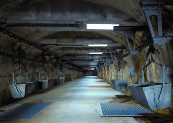
The Pyrite Harbour of Terra Rossa and Cala Violina
Cala Violina is a small cove bordered by two promontories, famous for its extremely white sand that, when trodden on or rubbed, produces a sound reminiscent of a violin. This phenomenon, which gave it its name, is due to the composition of the sand consisting almost exclusively of quartz grains. A few steps away from this enchanted place, you can admire a splendid example of industrial archaeology: Terra Rossa, an open-air museum where time has stood still. The vestiges of an ancient cableway, once the largest in Europe, which connected the inland mines to the port, together with silos, tunnels and deserted yards tell the story of an industrial epic that shaped the Park’s territory in the last century. A place where nature and history come together in an evocative and fascinating landscape.
Practical information
Visit the park
- Through the Gateways to the Park
- Contacting the Park Guides, email: [email protected]
- Self guided, following the Park’s rules of conduct and the Tracking App (Colline Metallifere Outdoor –)
- Booking some of the eco touristic experiences online at www.visitmaremma.net
How to get here
Travel green, help reduce emissions
If you want to reduce your impact, we recommend that you choose to reach us by train or bicycle.
Car rental with reduced impact (eco-driving)
Local travel is possible with vehicles that you can book on www.visitmaremma.net
All drivers have an eco-driving certificate, following training with the Eco2Trainer® method, which was initiated by the Sustainable Development Foundation. The eco-driving technique saves between 5 and 20% of pollutant and climate-changing emissions.
By car
From Rome
Take the SS 1 Aurelia, continue on the A12 motorway towards Civitavecchia, then take the SS 1 Aurelia towards Grosseto until the Giuncarico, Gavorrano, Scarlino and Follonica exits.
From Florence
Take the A1 Autostrada del Sole motorway, exit at Firenze Certosa, take the Firenze – Siena motorway towards Grosseto, continue on the SS 223 towards Grosseto Nord – Castiglione della Pescaia, continue on the SS 1 Aurelia until the Giuncarico, Gavorrano, Scarlino and Follonica exits.
From Livorno
Take the A12, exit at Rosignano and continue along the SS 1 Aurelia to the Follonica, Scarlino, Gavorrano and Giuncarico exits.
By Train
The reference railway station is Follonica.
By Plane
Pisa Airport (approx. 129 km north)
Florence Airport (approx. 186 km north)
Rome Fiumicino Airport (approx. 214 km south)